Trail difficulty
?
DRW
|
| Track : 8.-el_toboso-albacete.gpx |
|
These speeds are average for : Drawn track
(DRW) Reanalyze as BYC (Bicycle) HKG (Hiking) RNG (Running) |
|
|
| Level of correction applied to the trail: 0 |
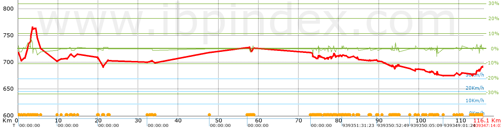
| Total length: 116.13 Km mi / ft ? |
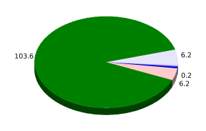
| Analyzed distance: 116.13 Km |
| Lineal distance: 105.77 Km |
| Accumulated climb: 133.7 m |
 info Points list info Points list |
| Accumulated descent: 121.7 m | |
| Maximum height: 765.4 m | |
| Minimal height: 675.2 m | |
| Start height: 714.6 m | |
| End height : 691.1 m | |
| Climb rate: 2.1 % | |
| Descent rate: 1.97 % | |
| Positive climb difference per Km: 1.15 m | |
| Negative descent difference per Km: 1.05 m | |
| Max slope filter: ~30 % |
| Min. points separation: ~30 m |
| Number of points: 206 (cad. 563.76 m) |
| Significant points: 195 (cad. 598.63 m / 94.66 %) |
| Direction changes per Km: 0.94 |
| Direction changes >5ş per Km: 0.82 |
| Accumulated straight stretches: 30.528 Km |
| Straight stretches per Km: 262.88 m |
| Penalizables slope changes: 1 |
| Penalizables slope changes per Km: 0.009 |
| Total time: 939347:14:07 h |
| Time in movement: 0:00:00 h |
| Stopped time: 939347:14:07 h |
| Total speed average: 0 Km/h |
| Average speed in movement : 0 Km/h |
| Maximum held speed: 0 Km/h |
 |
|
|
Remove track and analysis |
|
|
Save this trail on "My trails" |