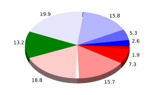
User: Password:   Login   Login with Facebook   Register

Send to a friend
   

Detailed analysis of the trail analyzed as Bicycle (BYC)
Trail difficulty
210
BYC
Track : cataluna-tarragona-gf-priorat.gpx
These speeds are average for : BYC (Bicycle)
Reanalyze as
HKG (Hiking) RNG (Running)
 Penalty trail's conditions: 68 %   ( > 50 % = MTB, < 50 % = RDB)
 Reliability of the original trail: A   (2890/78/0/-/-/78)
 Level of correction applied to the trail: 0
 Total length: 100.42 Km    mi / ft ?
 Analyzed distance: 100.42 Km
 Lineal distance: 0.03 Km
 Accumulated climb: 2890.6 m  info Points list
 Accumulated descent: 2867.8 m
 Maximum height: 723.2 m
 Minimal height: 84 m
 Start height: 351.6 m
 End height : 372.8 m
 Climb rate: 6.62 %
 Descent rate: 6.58 %
 Positive climb difference per Km: 28.79 m
 Negative descent difference per Km: 28.56 m
 Max slope filter: ~30 %
 Min. points separation: ~30 m
 Number of points: 1679   (cad. 59.81 m)
 Significant points: 1441   (cad. 69.74 m / 85.82 %)
 Direction changes per Km: 8.33
 Direction changes >5º per Km: 7.95
 Accumulated straight stretches: 3.297 Km
 Straight stretches per Km: 32.83 m
 Penalizables slope changes: 31
 Penalizables slope changes per Km: 0.309
 Total time: 6:38:44 h
 Time in movement: 6:30:09 h
 Stopped time: 0:08:35 h
 Total speed average: 15.11 Km/h
 Average speed in movement : 15.44 Km/h
 Maximum held speed: 59.3 Km/h
Your fitness level
24


Altitude Slope % Speed Km/h Speed < 2 Km/h

Steep slopes > 5%

Steep slopes >5% Steep slopes >10% Steep slopes >15% Steep slopes >20% Steep slopes >25%
 Steep slope of 246 m.  Average slope  Interval  Download as waypoint
1
 km 6.223  6%  246 m
 Steep slope of 142 m.  Average slope  Interval  Download as waypoint
2
 km 7.659  9%  142 m
 Steep slope of 733 m.  Average slope  Interval  Download as waypoint
3
 km 16.289  10%  733 m
 Steep slope of 487 m.  Average slope  Interval  Download as waypoint
4
 km 22.348  6%  487 m
 Steep slope of 1095 m.  Average slope  Interval  Download as waypoint
5
 km 24.453  7%  623 m
6
 km 25.076  11%  116 m
7
 km 25.192  8%  356 m
 Steep slope of 731 m.  Average slope  Interval  Download as waypoint
8
 km 25.769  7%  342 m
9
 km 26.111  14%  176 m
10
 km 26.287  8%  213 m
 Steep slope of 286 m.  Average slope  Interval  Download as waypoint
11
 km 27.253  10%  286 m
 Steep slope of 168 m.  Average slope  Interval  Download as waypoint
12
 km 29.911  7%  168 m
 Steep slope of 583 m.  Average slope  Interval  Download as waypoint
13
 km 33.151  9%  322 m
14
 km 33.473  12%  212 m
15
 km 33.684  7%  49 m
 Steep slope of 755 m.  Average slope  Interval  Download as waypoint
16
 km 33.939  7%  755 m
 Steep slope of 234 m.  Average slope  Interval  Download as waypoint
17
 km 35.274  10%  234 m
 Steep slope of 267 m.  Average slope  Interval  Download as waypoint
18
 km 37.35  7%  267 m
 Steep slope of 254 m.  Average slope  Interval  Download as waypoint
19
 km 40.142  6%  82 m
20
 km 40.224  13%  172 m
 Steep slope of 422 m.  Average slope  Interval  Download as waypoint
21
 km 42.89  6%  422 m
 Steep slope of 850 m.  Average slope  Interval  Download as waypoint
22
 km 43.448  8%  850 m
 Steep slope of 180 m.  Average slope  Interval  Download as waypoint
23
 km 44.445  7%  180 m
 Steep slope of 2165 m.  Average slope  Interval  Download as waypoint
24
 km 45.793  10%  496 m
25
 km 46.289  17%  184 m
26
 km 46.473  11%  169 m
27
 km 46.642  11%  487 m
28
 km 47.128  11%  168 m
29
 km 47.296  11%  164 m
30
 km 47.46  8%  206 m
31
 km 47.666  15%  240 m
32
 km 47.906  7%  51 m
 Steep slope of 205 m.  Average slope  Interval  Download as waypoint
33
 km 48.784  11%  205 m
 Steep slope of 413 m.  Average slope  Interval  Download as waypoint
34
 km 50.449  11%  320 m
35
 km 50.769  11%  93 m
 Steep slope of 235 m.  Average slope  Interval  Download as waypoint
36
 km 51.458  7%  235 m
 Steep slope of 441 m.  Average slope  Interval  Download as waypoint
37
 km 54.379  12%  136 m
38
 km 54.515  20%  122 m
39
 km 54.637  23%  88 m
40
 km 54.725  6%  95 m
 Steep slope of 421 m.  Average slope  Interval  Download as waypoint
41
 km 56.862  11%  288 m
42
 km 57.15  17%  133 m
 Steep slope of 284 m.  Average slope  Interval  Download as waypoint
43
 km 61.313  13%  231 m
44
 km 61.544  11%  53 m
 Steep slope of 257 m.  Average slope  Interval  Download as waypoint
45
 km 64.353  8%  257 m
 Steep slope of 314 m.  Average slope  Interval  Download as waypoint
46
 km 66.285  19%  216 m
47
 km 66.501  11%  98 m
 Steep slope of 733 m.  Average slope  Interval  Download as waypoint
48
 km 68.036  8%  733 m
 Steep slope of 969 m.  Average slope  Interval  Download as waypoint
49
 km 70.006  8%  969 m
 Steep slope of 250 m.  Average slope  Interval  Download as waypoint
50
 km 77.595  10%  250 m
 Steep slope of 1965 m.  Average slope  Interval  Download as waypoint
51
 km 77.987  7%  1167 m
52
 km 79.154  9%  265 m
53
 km 79.419  8%  247 m
54
 km 79.667  10%  286 m
 Steep slope of 247 m.  Average slope  Interval  Download as waypoint
55
 km 81.667  8%  247 m
 Steep slope of 758 m.  Average slope  Interval  Download as waypoint
56
 km 87.838  7%  73 m
57
 km 87.911  10%  331 m
58
 km 88.242  9%  354 m
 Steep slope of 207 m.  Average slope  Interval  Download as waypoint
59
 km 91.734  5%  207 m
 Steep slope of 1823 m.  Average slope  Interval  Download as waypoint
60
 km 92.786  14%  769 m
61
 km 93.555  16%  191 m
62
 km 93.746  14%  182 m
63
 km 93.928  9%  186 m
64
 km 94.114  10%  215 m
65
 km 94.329  9%  134 m
66
 km 94.463  11%  146 m
 Steep slope of 327 m.  Average slope  Interval  Download as waypoint
67
 km 97.744  6%  327 m


Compare this trail with...
Select trails to compare from "My trails". 
demo_montnegrebtt_2013.trk Ref.: 36172170671632
demo_matagalls_montserrat.trk Ref.: 36172170846048
demo_marathon_madrid_2013.trk Ref.: 36172170699197
Compare


Download (Registered users)

  GPX (.gpx)
  Garmin Training Center (.tcx)
  CompeGPS (.trk)
  OziExplorer (.plt)
  Google Earth (.kml)
  PDF analysis


Remove track and analysis
Save this trail on "My trails"


Send this analysis to a friend (Registered users)
Message that will receive your friend:
Re:
Hi.
(your name) has considered that this analysis of a trail could be of your interest.

(he/she will see a link to this page)
E-mail of your friend
You can enter multiple addresses separated by commas
Text
 
Send to a friend